
OmniPath AI
Every movement, unified in 3D.
Transforming spaces into business growth.
![[ OmniPath AI 3D space dashboard ]](/design/summit/omnipath-3d-viewer.webp)
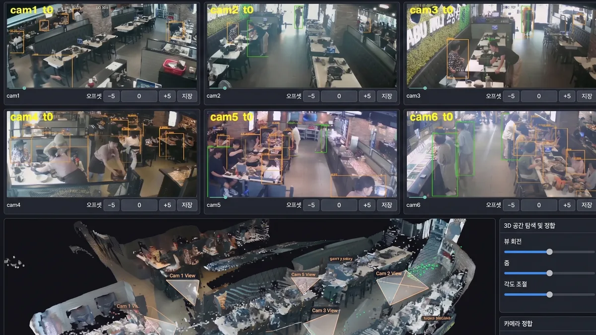
CCTV footage from multiple locations is unified in a single 3D environment.
Movement, dwell time, entries and exits, and congestion are analyzed by time of day.
The resulting data reveals how spaces are used and supports better operational and safety decisions.
Solutions Across Industries
Access spatial data tailored to each environment, from commercial facilities to industrial sites.
Generate practical metrics and insights for each facility and operational goal.
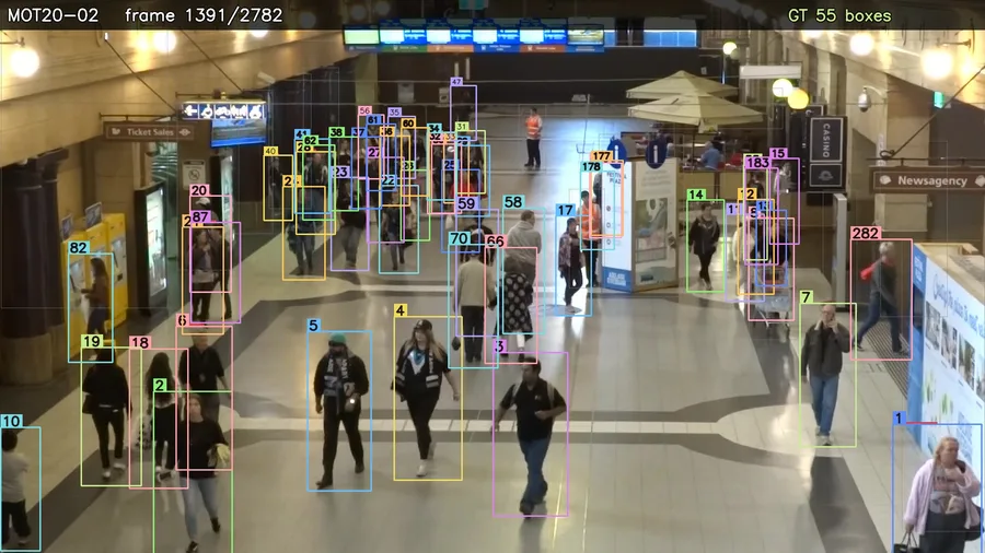
Analyze visitor paths across malls, department stores, and outlets to validate store layouts and promotion performance.
- Track dwell time and repeat visits by zone
- Compare foot traffic by storefront
- Optimize staffing and wayfinding during peak hours
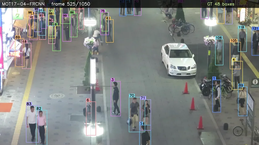
Unify camera feeds across airports, subway stations, and residential complexes within a single spatial framework.
- Monitor facility-wide entry and exit flows
- Detect congestion in real time and trigger alerts
- Identify unusual routes and bottlenecks early
Manage worker routes and equipment safety zones across factories and logistics centers to identify potential risks early.
- Detect and warn on restricted-area access
- Analyze workflow and equipment layout efficiency
- Generate safety reports automatically
Turn Existing CCTV into Spatial Decision Data
OmniPath AI unifies movement data from multiple CCTV feeds within a 3D spatial framework.
It connects individual movements into a continuous flow.
Existing camera footage reveals how spaces are used—without additional hardware.
Multi-Camera Spatial Integration
Reconstructs multiple camera feeds within one 3D spatial framework. Footage is aligned by spatial coordinates, regardless of camera placement or angle.
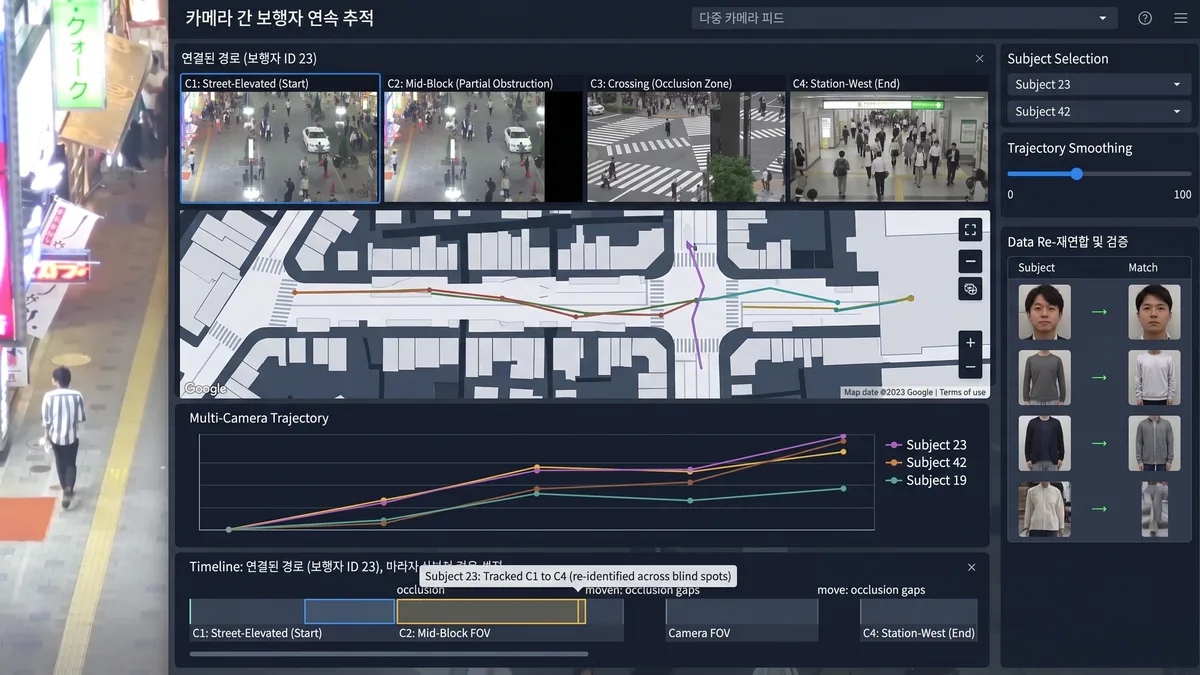
Continuous Cross-Camera Tracking
Connects the same person across different cameras into one movement path. The path remains continuous through camera blind spots.
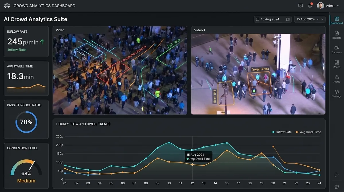
Movement, Dwell & Congestion Analytics
Converts movement paths into time-based operational metrics, including traffic, dwell time, pass-through rates, and movement frequency.
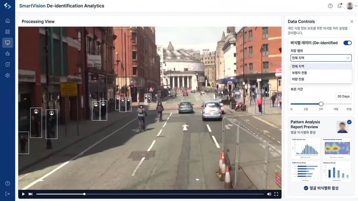
De-identified Data & Analytics Reports
Analyzes movement patterns without identifying individuals, including faces. Data scope and retention periods can be configured.
Pedestrian Tracking Ranked #1 on Global Benchmarks
Our core AI continuously tracks the same person across dense crowds and challenging capture conditions.
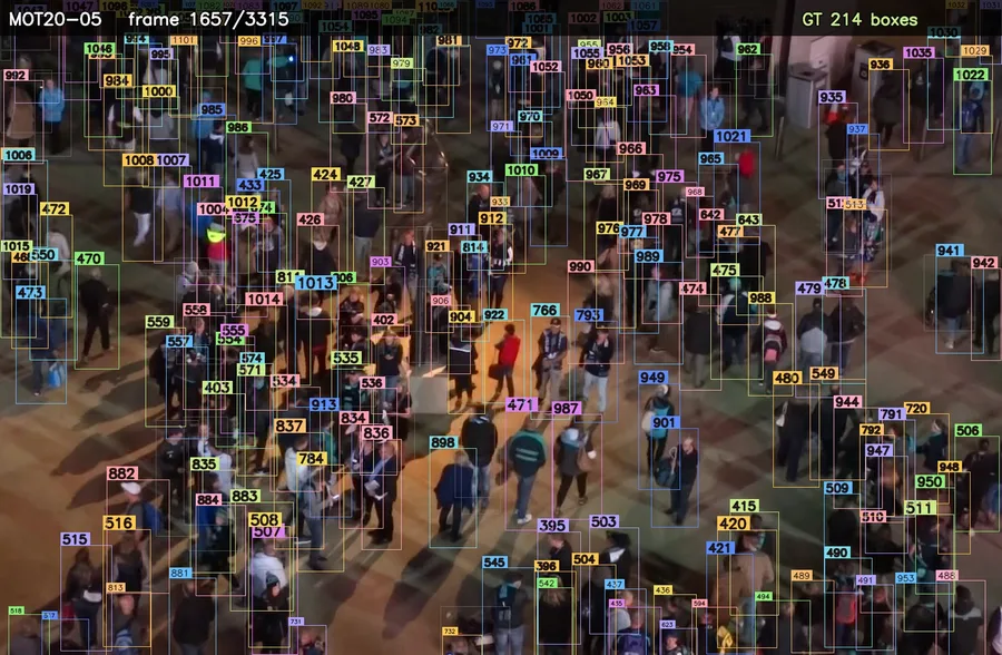
DEJAY ONE's proprietary pedestrian-tracking technology ranked #1 on both the MOT17 and MOT20 global benchmarks.
Proven to deliver uninterrupted tracking even from moving cameras, low-resolution footage, and low-light conditions.



Accurately tracks the movement of many overlapping objects even in dense environments like train stations, festivals, and stadiums.

Frequently Asked Questions
Q. Do I need to install new CCTV cameras?
No. OmniPath AI uses your existing CCTV footage without additional hardware. Analysis can begin once camera locations and angles are available.
Q. Is it compatible with all CCTV systems?
It supports a wide range of standard IP and analog CCTV streams. Compatibility is reviewed before deployment based on your equipment and capture environment.
Q. Can it analyze multiple floors or locations?
Yes. Footage from multiple floors, buildings, and locations can be unified in one spatial coordinate system. This supports both end-to-end and segment-level movement analysis.
Q. Are customer faces recognized or stored?
No personally identifiable information, including faces or physical characteristics, is stored. Only de-identified data such as movement paths and dwell time is analyzed.
Q. Can it integrate with existing systems?
Yes. Analytics data can be delivered to existing dashboards or operational systems through APIs, depending on your environment.
Q. Is a free pre-deployment consultation available?
Yes. We review your current CCTV environment and analysis goals, then outline the applicable scope and expected outcomes.
Q. How long does deployment take?
Timing depends on the number of cameras and the size of the space. Deployment typically takes several weeks from assessment to dashboard launch.
DEJAY ONE
Discover new spatial insights from your existing CCTV.
Use your current camera infrastructure with no additional hardware.